
Copper-Molybdenum (Gold,Silver)
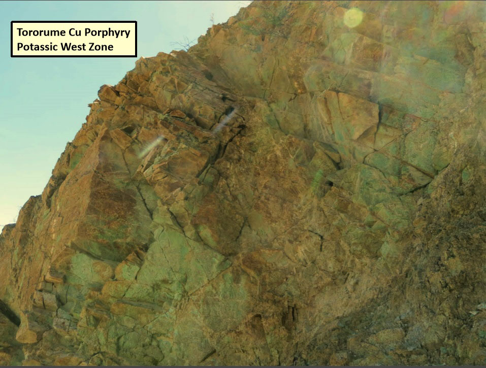
The Tororume project is located in southern Peru, one hundred and fifty kilometres northwest of Arequipa, 80 kilometres east of the Pacific coast and eight kilometres north of the Pecoy Cu deposit within the Southern Peru Costal Porphyry Copper Belt. The Property consists of 10,497 hectares owned 100% by Torion Mining S.A.C., a 100% owned subsidiary of Pembrook. HistoryThe Tororume porphyry system was discovered in 2013 by Pembrook while undertaking regional reconnaissance work within the Pecoy copper district in the Southern Peru Copper Porphyry Belt. This belt hosts major deposits such as the Cuajone Cu porphyry (Southern Peru Copper Corp.), the Toquepala Cu porphyry (Southern Peru Copper Corp.), Cerro Verde Cu porphyry (Freeport-McMoRan Copper & Gold Inc.) and the Zafranal Cu porphyry (Teck Resources Limited and Mitsubishi Materials Corporation). Exploration WorkTororume is a new discovery made by Pembrook and has never been drill tested. The Company has completed geological mapping, geochemical (rock- channel) sampling and geophysics (airborne magnetics, ground IP/resistivity). Geology- MineralizationThe Tororume porphyry system is three time larger than the Pecoy Porphyry system. It stretches over an area of two kilometres by five kilometres. The porphyry style mineralization intrudes the Cretaceous Coastal Batholitic granodiorite and basement gniesses. Copper, molybdenum and gold mineralization are present within granodiorite, basement gneiss and several Quartz Feldspar porphyry mineralized zones that exhibit strong porphyry-style alteration and quartz stockwork development. Multiple "centres" are present on the property with the best target to date a 250 metre by 400 metre West Potassic-altered zone in which 47 of 49 samples collected from this area returned >0.1% copper with the majority containing from 0.15% to 0.60% copper. This zone is covered by a thin, post-mineral, volcanic cap to the east and by debris to the south, and remains open in those directions and at depth. A second copper zone (North Phyllic Zone) is located 500 metres north of the West Potassic Zone and is characterized by quartz-sericite alteration (phyllic style) and contains multiple +0.1% copper to a high value of 15.6% copper associated with Chalcocite and malachite oxide mineralization. This zone exhibits substantial leaching at surface and covers an area measuring 800 metres by 1,000 metres. A third porphyry centre (East Potassic Zone) measuring 700 metres by 1,000 metres and with strong phyllic (quartz-sericite-pyrite) and potassic (magnetite-biotite) alteration is located east of the West Potassic Zone. The ground geophysical surveys carried out over the West and East Potassic zones suggests that they may link and are part of the same system. Surface RightsThe two permit areas on the Tororume project are on Federal land. The Company has submitted an application to acquire the surface rights and received a lease of Surface Rights from the government in 2017. Drill Program 2017The Phase 1 drill program will consist of 12 holes targeted across the West and East Potassic Zones. The first of two drill permits has been received and drilling on Permit 1 is scheduled to begin at the end of July starting with the testing of the East Potassic Zone. |
Tororume Image Gallery
click on image to view enlarged
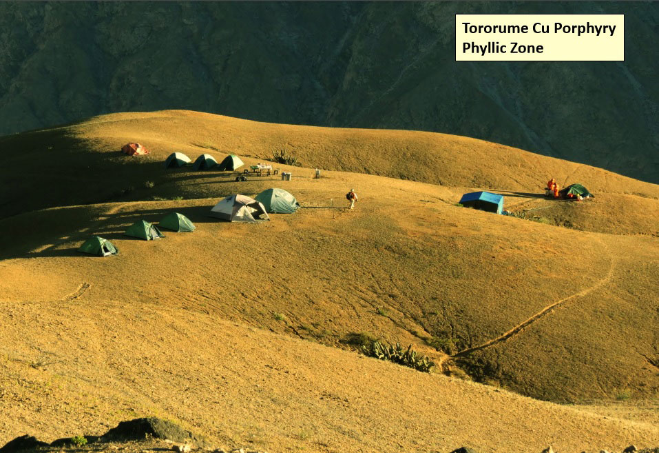
Phyllic Zone
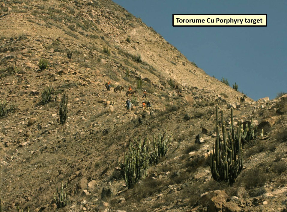
Porphyry

Potassic West Zone

Oxide Enrichment
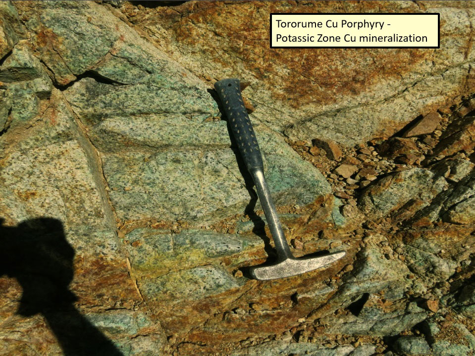
Potassic Zone
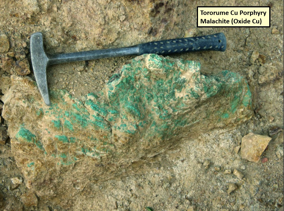
Malachite
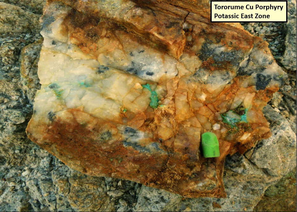
Potassic East Zone
Potassic West Zone